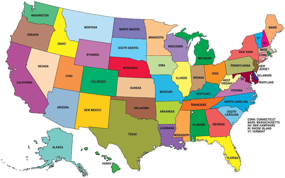
General Information:
CAPITAL CITY: Washington D.C
NATIONAL INDEPENDENCE: 4th of July
MOTTO: «In God We Trust»
LARGEST CITIES:
- New York City, NY.
- Los Angeles, CA.
- Chicago, IL.
- Houston, TX.
- Philadelphia, PA.
- Phoenix, AZ.
- San Antonio, TX.
- San Diego, CA.
- Dallas, TX.
- San Jose, CA.
HIGHEST POINT: Alaska, Mt. McKinley (Denali), 20,237.
LOWEST POINT: Badwater Basin in Death Valley, California. 85 m (279 feet) below sea level.
LARGEST STATE: Alaska
SMALLEST STATE: Rhode Island
NATIONAL BIRD: Bald eagle
NATIONAL ANTHEM: «The Star-Spangled Banner» by John Stafford Smith.
ASSOCIATE TERRITORIES: Puerto Rico, Guam, Islas Marianas del Norte, Samoa Americana, Islas Vírgenes de los Estados Unidos.
PHISYCAL FEATURES
Different regions or areas:
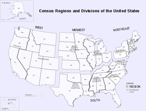
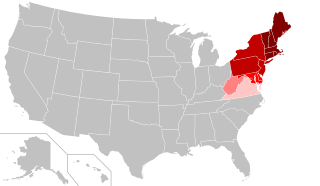
REGION 1: Northeast
The region has a total area of 469,630 km2 with 420,240 km2 of that being land mass.
With an average of 345.5 people per square mile, the Northeast is 2.5 times as densely populated as the second-most dense region, the South. Since the last century, the U.S. population has been shifting away from the Northeast (and Midwest) toward the South and West.
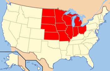
REGION 2: Midwestern
Today the population of the Midwest is 65,971,974, or 22.2% of the total population of the United States.
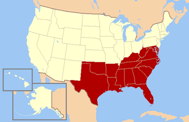
REGION 3: South
An estimated 122,696,385 people, or thirty-seven percent of all U.S. residents, lived in the South, the nation’s most populous region.
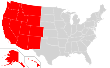
REGION 4: West
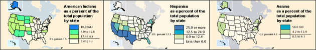
The population distribution by race in the Western United States:
PHYSICAL RELIEF
Mountains

Rivers and lakes

Climate
The climate of the United States varies due to differences in latitude, and a range of geographic features, including mountains and deserts. Generally, on the mainland, the climate of the U.S. becomes warmer the further south one travels, and drier the further west, until one reaches the West Coast.

